Voyager GPS OVERLAY helps improve situational awareness and provides emergency back-up to ECDIS.
Voyager GPS OVERLAY enables users to display live vessel GPS position in Voyager PLANNING STATION.
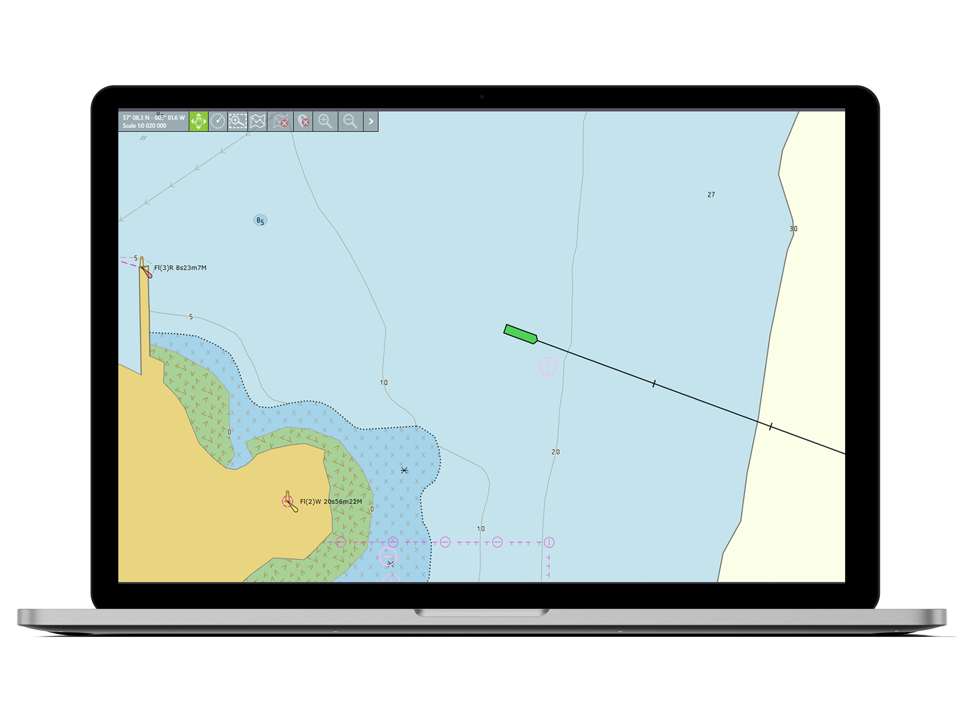
Vessel position displayed on official AVCS ENCs* enabling the bridge team to monitor and navigate**.
Use as an emergency navigation system in the event of multiple ECDIS failures and supports enhanced situational awareness. Requires USB to NMEA 0183 Gateway, AIS Pilot Plug USB or Bluetooth Pilot Plug Adapter.
Using the GPS OVERLAY the vessel’s live GPS position is displayed in real time either on the Voyager map or on official AVCS ENCs* to enable the bridge team to monitor vessel position and, if required, to navigate**.
Wired and wireless GPS USBs and Pilot Plugs can be purchased from Voyager Worldwide or users can use their own devices.
*Active AVCS subscription required
**The GPS OVERLAY in Voyager PLANNING STATION does not meet regulatory requirements for a second ECDIS and/ or a get you home paper chart back-up.
Yes, this application requires a GPS feed to the PC where the GPS OVERLAY application is installed. Users may use their own wired or Bluetooth GPS devices. Alternatively, GPS connections can be purchased from Voyager Worldwide for use within this service.
More than 1100 companies like yours rely on Voyager every day to help them improve safety and compliance, work more efficiently and drive increasingly valuable operational insights.
See it in action
View demosCall us on +44 191 257 2217 (UK) or +65 6270 4060 (SG)
Request a call backGet started now
Request your free trial