Navigating a new course with ECDIS
ECDIS is everywhere, but training and regulation have yet to catch up with its ubiquity onboard ship, meaning that mariners may not make the best use of the system, referring to it as a means of confirmation rather than a fully functional tool for digital navigation.
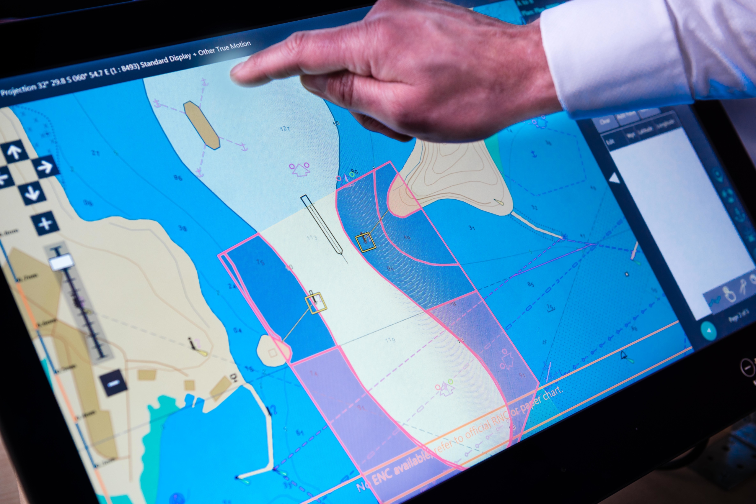
The proliferation of ECDIS as the primary means of navigation has seen the Electronic Navigation Chart become the standard source of navigation data, something that is not yet accurately reflected in the regulation and voyage planning guidelines on which navigation training and practice are based.
This ‘transitional’ state, in which neither training nor the guidelines for practice requirements accurately reflect the realities of ENC and ECDIS use at sea is anachronistic, contributing to knowledge and functionality gaps.
Neither does it recognise the new challenges encountered when voyage planning, monitoring and updating charts in ECDIS, and it encourages the teaching of conflicting navigational strategies (ENC and paper charts) in maritime colleges.
The fact that several large ship operators undertake their own bridge simulator training underlines the lack of trust and value in the current training arrangements. The IMO’s five-day ECDIS model course and familiarisation ‘on the go’ is far from sufficient when operating critical safety equipment.
These are the central conclusions of a survey undertaken by the UK and Danish Accident Investigation Boards, which found a difference between how ECDIS is actually being used and the intention of its designers.
The research followed a qualitative methodology, primarily based on interviews with 155 ECDIS users and observational data gathered over six months during voyages in European waters on 31 ships of various types.
Users identified the ECDIS’ main contributions to safe navigation as the reduction in workload and the increase in situational awareness resulting from real-time positioning. ECDIS’ reliability and the integration of ECDIS with other navigational systems were also seen as benefits.
Given that the various sources of information are usually accurate and that users rarely experienced malfunctions, they were generally found to trust the information provided by ECDIS and its technical reliability.
Some ECDIS functionalities were seen to reduce the manual labour of updating charts, plotting routes using waypoints, etc, but these functionalities were not necessarily viewed as contributing to safe navigation per se.
The study showed that while the standardisation and allocation of simple and repetitive tasks – plotting the ship’s position and chart update – has brought about tangible benefits, the required user interaction with ECDIS has introduced challenges that cut across system design, practices and training.
These challenges include the distraction of alerts and alarms, particularly during pilotage, that leads to coping strategies ranging between alarm ‘normalisation’ and physical disablement
The frequent impracticality of the setting of an efficient safety contour can lead to the use of ‘official workarounds’ (eg those included in recognised guidance) and ‘unofficial workarounds’ (eg disabling alarms) to optimise the display to make the best of a bad job. Alternatively, the safety contour is ignored altogether.
The number and types of alerts generated during automatic route checks leads to them either being ignored or increases the risk of planners missing safety critical alerts among numerous more trivial ones. Interfaces and menu complexity increase cognitive workload, particularly in busy environments, which results in users focusing on ECDIS to the detriment of other sources of information.
The difficulty of residual manual tasks such as planning radar parallel indices, plotting limiting danger lines or writing text notes, which are often time-consuming, deters users from their application. The report also notes that ECDIS requires significant cognitive resources to use its functions, which has contributed to a minimalist approach by users.
In terms of inspections, ECDIS use continues to be framed and audited within the context of paper chart practices with Flag State, Port State and vetting inspections which do not often recognise new ways of working such as the use of radar information overlay to verify position.
Most concerningly, some users are trained to distrust the ECDIS and continuously verify the ship’s position by alternative means, even though significant discrepancies are rarely encountered.
From a user perspective, the study found that ECDIS does contribute to safe navigation, but the challenges that have accompanied its introduction are problematic. Some of these challenges stem from the system’s automation not always working efficiently due either to the lack of bathymetric fidelity (ie the provision of depth contours in the same manner as provided on paper charts) and/or human-centred design not being considered.
Other challenges stem from industry inertia, with ECDIS being viewed in the same way as paper charts, ie a homogenous work process requiring a uniform skill set across different ships and trades. However, ECDIS is not a standardised and automated paper chart. It is a technology that provides a new form of situated knowledge by contextualising information from various sources, providing a different perspective on the navigational situation.
ECDIS has expanded the bridge watchkeeper’s role in maintaining the safety of a vessel by increasing the data available that requires management, assessment and interpretation. It has also made navigational practices diverse in character and content, necessitating different types of training, procedures and technology solutions.
Although ECDIS use has been incorporated to some degree in the relevant conventions, the ‘best’ practices cited by many remain are those often associated with paper charts. Paper chart practices remain at the heart of navigation training in nearly all maritime colleges worldwide but as ECDIS use proliferates, and related practices and skills develop, it seems impossible that such a strategy can continue.