Week 25 2022: Top picks from this week’s latest publication releases
| This week’s New Editions
Top picks from this week’s latest maritime publication releases and important regulatory guidance for each title to help you decide if it’s requirement for your vessels. |
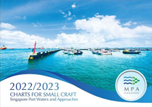 |
MPA – Charts for small crafts (2022/2023) Recommended for vessels in Singapore waters [Code: MPA 003] The Charts for Small Craft is an atlas specifically for use by the operators of small vessels and recreational sailors. Produced by the Hydrographic Division of the Maritime and Port Authority of Singapore, it is consistent with the chart standards and specifications set out by the International Hydrographic Organization (IHO). The publication contains 12 charts and related nautical information bound into an atlas measuring 60cm x 40cm. The publication includes information on pleasure craft facilities as well as sea sport activities such as sailing and power boating. |
 |
Reeds Marine Distance Tables (17th Edition/ 2022)
Recommended for all vessels. [Code: REED 016] Hard copy only The book is divided into key ‘market areas’, and includes a pull-out map for area identification and easy see-at-a-glance port reference. Traffic Separation Schemes are calculated into the tables whilst the distance to any port not included can easily be determined by making an approximation from the next closest port. Useful tables of major ‘turning points’ around the world (such as Cape Finisterre, Cape Horn and the Dover Straits), Transatlantic distances, world time zones, and time and speed conversion tables are also included. As well as incorporating general updates and improvements, this edition has been expanded to include distances for the Faroes, Shetlands and Orkneys. Freighter movements, cargo tonnage and cruise ship destinations have all been factored into considering details on the top ten busiest ports worldwide. |
| New Editions for pre-ordering |
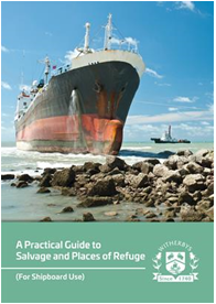 |
A Practical Guide to Salvage and Places of Refuge – (For Shipboard Use)
Recommended for all vessels. [Code: WITH 013/ WITH 013-EB]
Hard copy and eBook This Guide deals with the practical aspects of salvaging a ship and the implications for a ship that requires a Place of Refuge. It contains comprehensive guidance on the two related aspects of salvage and Place of Refuge for the ship Master, bridge team and the ship owning/operating company |
 |
Biofouling, Biosecurity and Hull Cleaning
Recommended for all vessels [Code: WITH 012/ WITH 012-EB]
Hard copy and eBook This publication describes the various types of biofouling and the problems it can cause for ship operation and the marine environment. It examines the use of anti-fouling systems to prevent the build-up of biofouling as well as the options available for ship cleaning. It also sets out biofouling legislation and guidelines. The book includes data sheets for a number of hull cleaning companies worldwide.
|
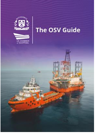 |
The OSV Guide
Recommended for OSV vessels [Code: WITH 801/ WITH 801-EB]
Hard copy and eBook This publication is a guide to the operation and management of offshore support vessels (OSVs). The Guide describes the differences between the offshore industry and conventional marine activity, covering areas such as towing procedures and environmental regulatory compliance. It is designed to be a valuable aid to learning and a useful reference source, particularly when complemented by other training resources.
|
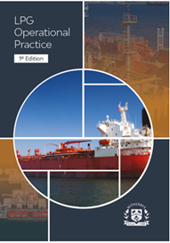 |
Witherbys – LPG Operational Practice (1st Edition)
Recommended for LPG vessels [Code: WITH 789/ WITH 789-EB]
Hard copy and eBook
This first edition is designed to give ships’ officers, tanker terminal personnel and terminal management an understanding of the principles involved in the safe loading, transportation and discharging of liquefied petroleum gases and chemical gases. The notes include both theoretical and practical aspects of ship operations, covering in-service, pre-arrival and post-transfer phases. |
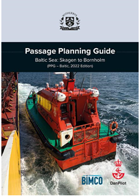 |
Witherbys – Passage Planning Guide, Baltic Sea: Skagen to Bornholm (PPG – Baltic, 2022 Edition)
Recommended for vessels navigating in Baltic Sea: Skagen to Bornholm [Code: WITH 788/ WITH 788-EB]
Hard copy and eBook
Passing the Danish Straits, either by the Great Belt or the Sound, leads ships through shallow water, strong currents, harsh weather conditions and high density of traffic, making it a complex challenge for mariners. The Passage Planning Guide – Baltic Sea: Skagen to Bornholm has been developed through cooperation between Witherbys, DanPilot and BIMCO to provide an overview for mariners and to assist in proper planning for a ship transiting in this area. The purpose of this Guide is to provide navigators with the details of recommended routes, routeing measures and reporting systems when passing through this restricted sea area. The information has been supplemented by expert guidance on confronting the particular difficulties presented by traffic, water flow and weather patterns from pilots who operate in the region. This Guide aims to provide navigators with the information they need to support the pilot during their transit through this region. |
| To pre-order New Editions, simply email us at customerservices@voyagerww.com, or contact your preferred Voyager Worldwide office here. |
| OUTFIT MANAGEMENT TABLE |
| Forthcoming New Admiralty Charts/New Edition Charts to be Published in Week 25 |
| Chart
Title |
Chart Title | NE/NC | Date |
| 1292 | International Chart Series, France and Spain, Mimizan-Plage to Cabo De Ajo. | NE | 23.06.2022 |
| 2120 | France – South Coast, Toulon to Cavalaire-Sur-Mer including Îles D’Hyères. | NE | 23.06.2022 |
| 2743 | International Chart Series, France – West Coast, Approaches to La Rochelle. | NE | 23.06.2022 |
| Forthcoming Charts to be Withdrawn in Week 25 |
| Chart Number | Chart Title | Replacement Chart Number |
| 1292 | International Chart Series, France and Spain, Mimizan-Plage to Cabo de Ajo. | 1292 |
| 2120 | France – South Coast, Toulon to Cavalaire-Sur-Mer Including Îles d’Hyères. | 2120 |
| 2743 | International Chart Series, France – West Coast, Approaches to La Rochelle. | 2743 |
| Forthcoming New Edition Publications to be Published in Week 25 |
| NP No. | Title | Date | Remarks |
| NP202-23 | ADMIRALTY Tide Tables
North Atlantic Ocean and Arctic Regions Volume 2, 2023 Edition.
ISBN Number: 978-0-70-772-2481 |
23/06/2022 | New Edition. |
| NP321-23 | Her Majesty’s Nautical Almanac Office.
Astronomical / Surveying Publication. The Star Almanac for Land Surveyors for the year 2023.
ISBN Number: 978-0-70-774-6319 |
23/06/2022 | This almanac gives positions of the Sun, Polaris and
selected bright stars, accurate to about 1 arcsecond, which may be used to determine a geographical position or direction to true north using astronomical observations. A pdf version of the almanac and files of coefficients in ASCII format, representing the positions of the Sun and stars, are included on the accompanying CD-Rom. |
 |
How can we help?
Our help team is on call 24/ hours a day 7 days a week including holidays. To speak with our Customer Service team, simply email us at customerservices@voyagerww.com, or contact your preferred Voyager Worldwide office here.
|