Week 44: Top picks from this week’s latest publication releases
| This week’s New Editions
picks from this week’s latest maritime publication releases and important regulatory guidance for each title to help you decide if it’s requirement for your vessels. |
|
LBR 501 – Liberian Combined Publication Folder RLM 300 – Aug 2020 Essential for all Liberian Flag ShipsThe 2020 edition of the full and updated RLM 300 contains the latest version of the Combined Publications Folder (CPF) RLM 300 now in digital format, including updates/ revisions and new Marine Notices through Jul 2020.LBR 501 – Liberian Combined Publication Folder RLM 300 CD Essential for all Liberian Flag ShipsCPL/RLM 300 or CPL RLM 300 CD is required to be carried onboard each vessel in accordance with Liberian Maritime Regulation 1.13(3). The eRLM 300 CD meets the requirement for maintain the Laws and Regulations aboard Liberian flagged vessels. |
 |
WITH 005 – Peril at Sea and Salvage (A Guide for Masters) – 6th Ed – Oct 2020 Recommended for all vessels. A standard reference for Masters for forty years, this new edition of Peril at Sea and Salvage: A Guide for Masters reflects major changes that have taken place in the shipping industry since the last edition was published.It outlines the actions a Master should take when confronted with an emergency: from the initial assessment and immediate actions, through to towage or salvage arrangements, as may be necessary.It also explains the importance of prompt notification to relevant parties, particularly coastal States and the company. A section is included with recommendations for a company’s shore-based personnel. |
 |
NP 285 – Admiralty List of Radio Signals: Global Maritime Distress and Safety System (GMDSS), 1st Edition 2020 – Oct 2020
This volume includes: · Worldwide communication requirements for distress, search and rescue · Extracts from SOLAS and ITU Regulations · Distress and SAR (incorporating MRCC and MRSC contacts) · Worldwide NAVTEX and Maritime Safety Information In addition to paper format, ADMIRALTY List of Radio Signals is available as an ADMIRALTY Digital Publication (ADP). ADPs bring improved efficiency, accuracy and access to information bridge crews need through electronic NM updates and simple search functionality. |
 |
DP330 – NavPac and Compact Data – 2021 – 2025 CD ROM – Oct 2020
ADMIRALTY NavPac and Compact Data provides navigators and astronomers with simple and efficient methods for calculating the position of the sun, moon, navigational planets and stars with the aid of a personal computer running Microsoft Windows 8 and 10. It allows navigators to compute their position at sea using traditional celestial navigation techniques combined with modern technology. ADMIRALTY NavPac and Compact Data is used world-wide by the Royal Navy and other navies around the world as well as commercial navigators who use it to provide independent and reliable verification to their on-board Global Navigation Satellite System (GNSS). |
 |
NP 047 – Admiralty Sailing Directions: Mediterranean Pilot Volume 3, 17th Edition 2020 – Oct 2020
Covers the Ionian Sea bordering the West coast of Greece, inc. Patraikos Kolpos and Korithiakos Kolpos and the Adriatic Sea. Often referred to as Pilots, Sailing Directions are designed for use by the merchant mariner on all classes of ocean-going vessels with essential information on all aspects of navigation. Sailing Directions are complementary to ADMIRALTY Standard Nautical Charts and provide worldwide coverage in 74 volumes. In addition to paper format, each volume of ADMIRALTY Sailing Directions is available as an ADMIRALTY e-Nautical Publication (AENP). AENPs bring improved efficiency, accuracy and access to information bridge crews need through electronic NM updates and simple search functionality. |
 |
NP 079 – Admiralty List of Lights and Fog Signals (ALL) Volume F: North-East Indian Ocean, Central part of South China and Eastern Archipelagic Sea (North of the Equator), 1st Edition (2020) – Oct 2020
North-East Indian Ocean, Central part of South China and Eastern Archipelagic Sea (North of the Equator), excluding China and South-West part of Philippines Sea Each publication also gives the characteristics of lights and fog signals, together with the equivalent foreign language light descriptions. Tables can be used to calculate the geographical and luminous ranges of lights. Details for all lights listed include the international number, location and/or name, geographical co-ordinates, characteristics and intensity, elevation in metres, range in sea miles and description of structure. In addition to paper format, ADMIRALTY List of Lights & Fog Signals is available as an ADMIRALTY Digital Publication (ADP). ADPs bring improved efficiency, accuracy and access to information bridge crews need through electronic NM updates and simple search functionality. |
| To order, contact our Customer Service Team at customerservices@voyagerww.com |
 |
WITH 104 – ICS Tanker Safety Guide (Chemicals), 5th Edition – Jan 2021 Recommended for Chemical TankersThe ICS Tanker Safety Guide (Chemicals) is the standard reference work for chemical tankers. Now in its fifth edition, the Guide provides chemical tanker operators and crew with up-to-date best practice guidance for safe and pollution-free operations on chemical tankers and oil tankers carrying chemical cargoes in accordance with MARPOL Annex II.The fifth edition contains valuable new guidance on key safety issues and operations, is fully aligned with ISGOTT: International Safety Guide for Oil Tankers and Terminals, Sixth Edition and provides new and improved ship/shore safety checklists. It should be carried on all chemical tankers and should be readily accessible by anyone involved in the carriage of chemicals on ships, including ship operators, cargo interests, training institutes and terminal operators. |
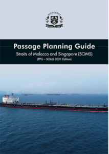 |
WITH 213 – Passage Planning Guide – Straits of Malacca and Singapore, (PPG – SOMS 2021 Edition) – Dec 2020 Recommended for all vessels transiting Malacca and Singapore straits This 2021 edition of the Passage Planning Guide Straits of Malacca and Singapore (SOMS) has been completely revised to incorporate the latest guidance and practical advice for ships transiting the region. This comprehensive guide contains the latest navigational guidance and practical advice for the region including details of traffic hotspots, Straits Pilot Services, TSS and VTS information. |
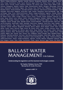 |
WITH 284 – Ballast Water Management 11th Edition – Nov 2020 Recommended for all vesselsThis 11th edition of ‘Ballast Water Management’ sets out the current international and national ballast water legislation and provides essential information on compliance.It discusses the various treatment options available and summarises the IMO and USCG Type Approved BWMS currently on the market.It also highlights the significant date of 28th October 2020, after which point only BWMS with revised 2016 G8/BWMS Code Type Approval are permitted to be installed on ships.A key feature of this new edition is a set of data sheets setting out BWMS that meet these revised standards. These data sheets present System Design Limitations, which are essential aids to shipowners when evaluating and selecting a BWMS. |
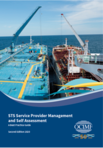 |
STS Service Provider Management and Self Assessment, Second Edition 2020 – Nov 2020 Recommended for Ships engaged in STS Operations and her ManagementOCIMF’s STS Service Provider Management and Self Assessment is an important tool that helps Ship to Ship Service Providers assess, measure and improve the safety and effectiveness of their management systems. This second edition has been updated to reflect current legislation, expectations and emerging issues and incorporates feedback from STS Service Providers and users of the first edition. It is based on the principles of the Tanker Management and Self Assessment (TMSA 3) programme that was revised in 2017.Key updates to this edition:• Where applicable, the elements have been aligned with TMSA 3 • A new element has been added that covers Maritime Security • The ‘Reliability and Maintenance of STS Equipment’, the ‘Due Diligence Regarding Transhipment Locations’ and the ‘STS Operations’ elements have been expanded to include new sections • The ‘Environmental and Energy Management’ element now incorporates the OCIMF Energy Efficiency and Fuel Management paper that was a supplement to TMSA 2 • Elements have been streamlined and merged to improve consistency and make self-assessment easier • The best practice guidance has been expanded to complement the key performance indicators and revised to remove ambiguity and duplication. |
| To pre-order New Editions, contact our Customer Service Team at customerservices@voyagerww.com |
| OUTFIT MANAGEMENT TABLE |
| Forthcoming New Admiralty Charts/New Edition Charts to be Published in Week 44 |
| Chart
Title |
Chart Title | NE/NC | Date |
| PNG516 | Papua New Guinea, North East Coast, Trobriand Islands to Lusancay Islands | NE | 29.10.2020 |
| PNG521 | Papua New Guinea, North East Coast, Dyke Ackland Bay to Cape Ward Hunt | NE | 29.10.2020 |
| PNG522 | Papua New Guinea, North East Coast, Cape Ward Hunt to Nassau Bay | NE | 29.10.2020 |
| 32 | International Chart Series, England – South Coast, Falmouth to Truro | NE | 29.10.2020 |
| 207 | International Chart Series, Netherlands, Hoek van Holland to Vlaardingen | NE | 29.10.2020 |
| 921 | Indonesia, Jawa – North Coast, Selat Surabaya,
Sheet 4 |
NE | 29.10.2020 |
| 931 | Denmark, Kattegat, Odense Fjord | NE | 29.10.2020 |
| 1196 | International Chart Series, Mediterranean Sea, Spain – East Coast, Approaches to Barcelona | NE | 29.10.2020 |
| 1251 | China and Korea – Yellow Sea, Dadong Gangqu and Approaches | NE | 29.10.2020 |
| 1847 | International Chart series, North Atlantic Ocean, Islas Canarias, Isla de Tenerife, Santa Cruz de Tenerife | NE | 29.10.2020 |
| 1854 | Mediterranean Sea, Spain – South Coast, Motril and Adra | NE | 29.10.2020 |
| 1859 | International Chart Series, England -West Coast, Port of Bristol | NE | 29.10.2020 |
| 2583 | Baltic Sea – Denmark, Smålandsfarvandet, Western Part | NE | 29.10.2020 |
| 3449 | China – Taiwan Strait, Approaches to Xiamen Gang | NE | 29.10.2020 |
| 3452 | China – Taiwan Strait, Gulang Yu to Xinglin | NE | 29.10.2020 |
| 3453 | China – Taiwan Strait, Jiulongjiang Kou | NE | 29.10.2020 |
| 4030 | Port of Singapore,West Jurong Anchorages and Temasek Fairway | NE | 29.10.2020 |
| 4031 | Port of Singapore,Western Approaches to Jurong Island | NE | 29.10.2020 |
| AUS55 | Australia – North West Coast, Western Australia, Approaches to Port Walcott | NE | 29.10.2020 |
| PNG520 | Papua New Guinea – North East Coast, Cape Nelson to Dyke Ackland Bay | NE | 29.10.2020 |
| Forthcoming New Edition Publications to be Published in Week 44 |
| Chart Number | Chart Title | Replacement Chart Number |
| 32 | International Chart Series, England – South Coast, Falmouth to Truro | 32 |
| 207 | International Chart Series, Netherlands, Hoek van Holland to Vlaardingen | 207 |
| 921 | Indonesia, Jawa – North Coast, Pelabuhan Surabaya and Approaches | 921 |
| 931 | Denmark, Kattegat, Odense Fjord | 931 |
| 1196 | International Chart Series, Mediterranean Sea, Spain – East Coast, Approaches to Barcelona | 1196 |
| 1251 | China and Korea – Yellow Sea, Dadong Gangqu and Approaches | 1251 |
| 1847 | International Chart series, North Atlantic Ocean, Islas Canarias, Isla de Tenerife, Santa Cruz de Tenerife | 1847 |
| 1854 | Mediterranean Sea, Spain – South Coast, Motril and Adra | 1854 |
| 1859 | International Chart Series, England – West Coast, Port of Bristol | 1859 |
| 2583 | Baltic Sea – Denmark, Smålandsfarvandet, Western Part | 2583 |
| 3449 | China – Taiwan Strait, Approaches to Xiamen Gang | 3449 |
| 3452 | China – Taiwan Strait, Gulang Yu to Xinglin | 3452 |
| 3453 | China – Taiwan Strait, Jiulongjiang Kou | 3453 |
| 4030 | Port of Singapore, West Jurong Anchorages and Temasek Fairway | 4030 |
| 4031 | Port of Singapore, Western Approaches to Jurong Island | 4031 |
| AUS55 | Australia – North West Coast, Western Australia, Approaches to Port Walcott | AUS55 |
| AUS56 | Australia – North West Coast, Western Australia, Port Walcott | AUS56 |
| AUS516 | Papua New Guinea, North East Coast, Trobriand Islands to Lusancay Islands | AUS516 |
| PNG520 | Papua New Guinea, North East Coast, Cape Nelson to Dyke Ackland Bay | PNG520 |
| AUS521 | Papua New Guinea, North East Coast, Dyke Ackland Bay to Cape Ward Hunt | PNG521 |
| PNG522 | Papua New Guinea, North East Coast, Cape Ward Hunt to Nassau Bay | PNG522 |
| 8108 | Port Approach Guide, Longkou | Withdrawn |
| 8114 | Port Approach Guide, Zhuhai Gang Gaolan Ganghu | Withdrawn |
| 8130 | Port Approach Guide, Yantai (Zhifuwan Gangqu) | Withdrawn |
| 8131 | Port Approach Guide, Approaches to Yantai Gang | Withdrawn |
| 8151 | Port Approach Guide, Shidao | Withdrawn |
| 8159 | Port Approach Guide, Zhanjiang | Withdrawn |
| 8169 | Port Approach Guide, Lanshan | Withdrawn |
| 8170 | Port Approach Guide, Lianyungang, Eastern Part | Withdrawn |
| 8171 | Port Approach Guide, Lianyungang, Western Part | Withdrawn |
| Forthcoming New Edition Publications to be Published in Week 44 |
| NP No. | Title | Date | Remarks |
| NP47&
e-NP47 |
ADMIRALTY Sailing Directions.
Mediterranean Pilot Volume 3 (Seventeenth Edition) 2020.
ISBN Number: 978-0-70-774-5756 |
29/10/20 | Updated to Week 31/20 (30/07/20) First updates in NM week 44/20. This edition supersedes NP47 (Sixteenth
Edition 2017) which is cancelled |
| NP79 | ADMIRALTY List of Lights and Fog Signals Volume F 2020 North-East Indian Ocean, Central part of South China and Eastern Archipelagic Seas
(North of the Equator), excluding China, and South-West part of Philippine Sea.
ISBN Number: 978-0-70-772-4195 |
29/10/20 | Updated to NM Week 39/20
(24/09/20). First updates in NM Week 44/20. Volume F 2019/20 is cancelled |
 |
How can we help?
Our help team is on call 24/ hours a day 7 days a week including holidays. To speak with our Customer Service team, simply email us at customerservices@voyagerww.com, or contact your preferred Voyager Worldwide office here.
|

