Week 41: Top picks from this week’s latest publication releases
| This week’s New Editions Top picks from this week’s latest maritime publication releases and important regulatory guidance for each title to help you decide if its requirement for your vessels. |
||
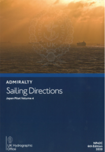 |
NP 042C – Admiralty Sailing Directions: Japan Pilot Volume 4, 6th Edition (2020) – Oct 2020
Nansei Shoto; east, west and north-west coasts of Kyushu, and Tsushima. Often referred to as Pilots, Sailing Directions are designed for use by the merchant mariner on all classes of ocean-going vessels with essential information on all aspects of navigation. Sailing Directions are complementary to ADMIRALTY Standard Nautical Charts and provide worldwide coverage in 74 volumes. In addition to paper format, each volume of ADMIRALTY Sailing Directions is available as an ADMIRALTY e-Nautical Publication (AENP). AENPs bring improved efficiency, accuracy and access to information bridge crews need through electronic NM updates and simple search functionality. |
|
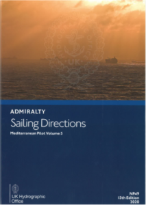 |
NP 049 – Admiralty Sailing Directions: Mediterranean Pilot, Volume 5, 15th Edition (2020) – Oct 2020 Covers the coasts of Libya, Egypt, Israel, Lebanon and Syria, the South coasts of the Greek Islands from Kríti (Kriti) to Ródos (Rodos) and Turkey with the island of CyprusOften referred to as Pilots, Sailing Directions are designed for use by the merchant mariner on all classes of ocean-going vessels with essential information on all aspects of navigation. Sailing Directions are complementary to ADMIRALTY Standard Nautical Charts and provide worldwide coverage in 74 volumes.In addition to paper format, each volume of ADMIRALTY Sailing Directions is available as an ADMIRALTY e-Nautical Publication (AENP). AENPs bring improved efficiency, accuracy and access to information bridge crews need through electronic NM updates and simple search functionality. |
|
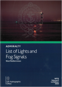 |
NP 078 – Admiralty List of Lights & Fog Signals (ALL) Volume E: West Mediterranean, 1st Edition (2020) – Oct 2020
West Mediterranean Each publication also gives the characteristics of lights and fog signals, together with the equivalent foreign language light descriptions. Tables can be used to calculate the geographical and luminous ranges of lights. Details for all lights listed include the international number, location and/or name, geographical co-ordinates, characteristics and intensity, elevation in metres, range in sea miles and description of structure. In addition to paper format, ADMIRALTY List of Lights & Fog Signals is available as an ADMIRALTY Digital Publication (ADP). ADPs bring improved efficiency, accuracy and access to information bridge crews need through electronic NM updates and simple search functionality. |
|
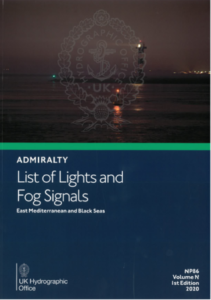 |
NP 086 – Admiralty List of Lights and Fog Signals (ALL) Volume N: East Mediterranean and Black Seas, 1st Edition (2020) – Oct 2020 East Mediterranean and Black Seas.Each publication also gives the characteristics of lights and fog signals, together with the equivalent foreign language light descriptions. Tables can be used to calculate the geographical and luminous ranges of lights. Details for all lights listed include the international number, location and/or name, geographical co-ordinates, characteristics and intensity, elevation in metres, range in sea miles and description of structure.In addition to paper format, ADMIRALTY List of Lights & Fog Signals is available as an ADMIRALTY Digital Publication (ADP). ADPs bring improved efficiency, accuracy and access to information bridge crews need through electronic NM updates and simple search functionality |
|
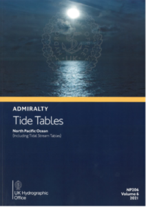 |
NP 206-21 – Admiralty Tide Tables (ATT) Volume 6: North Pacific Ocean (Including Tidal Stream Tables), (2021 Edition) – Oct 2020 This is the six of six parts of the British Admiralty Tide Tables. It covers the North Pacific Ocean including Tidal Stream Tables.Admiralty Tide Tables detail the times and heights of high and low waters for over 230 standard and 6000 secondary ports in the UK and Ireland, Europe, the Indian Ocean, South China Sea and Pacific Ocean for each day of the year. The tables outline methods of prediction, the effect of meteorological conditions on tides and provide additional information on exceptional tidal factors in each area.In addition to paper format, ADMIRALTY Tide Tables is available as an ADMIRALTY Digital Publication (ADP). ADPs bring improved efficiency, accuracy and access to information bridge crews need through electronic NM updates and simple search functionality. |
|
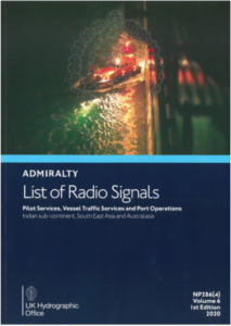 |
NP 286 (4) – Admiralty List of Radio Signals: Pilot Services, Vessel Traffic Services and Port Operations (ALRS) Volume 6, Part 4 – Indian sub-continent, South East Asia and Australasia, 1st Edition (2020) – Oct 2020
This is the fourth of six parts of the British Admiralty Tide Tables. It covers the Indian sub-continent, South East Asia and Australasia including Tidal Stream Tables. Admiralty Tide Tables detail the times and heights of high and low waters for over 230 standard and 6000 secondary ports in the UK and Ireland, Europe, the Indian Ocean, South China Sea and Pacific Ocean for each day of the year. The tables outline methods of prediction, the effect of meteorological conditions on tides and provide additional information on exceptional tidal factors in each area. In addition to paper format, ADMIRALTY Tide Tables is available as an ADMIRALTY Digital Publication (ADP). ADPs bring improved efficiency, accuracy and access to information bridge crews need through electronic NM updates and simple search functionality. |
|
| To order contact our Customer Service Team at customerservices@voyagerww.com |
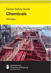 |
WITH 104 – ICS Tanker Safety Guide (Chemicals), 5th Edition – Jan 2021
The ICS Tanker Safety Guide (Chemicals) is the standard reference work for chemical tankers. Now in its fifth edition, the Guide provides chemical tanker operators and crew with up-to-date best practice guidance for safe and pollution-free operations on chemical tankers and oil tankers carrying chemical cargoes in accordance with MARPOL Annex II. The fifth edition contains valuable new guidance on key safety issues and operations, is fully aligned with ISGOTT: International Safety Guide for Oil Tankers and Terminals, Sixth Edition and provides new and improved ship/shore safety checklists. It should be carried on all chemical tankers and should be readily accessible by anyone involved in the carriage of chemicals on ships, including ship operators, cargo interests, training institutes and terminal operators.
|
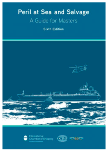 |
WITH 005 – Peril at Sea and Salvage (A Guide for Masters) – 6th Ed – Oct 2020 Recommended for all vessels.A standard reference for Masters for forty years, this new edition of Peril at Sea and Salvage: A Guide for Masters reflects major changes that have taken place in the shipping industry since the last edition was published.It outlines the actions a Master should take when confronted with an emergency: from the initial assessment and immediate actions, through to towage or salvage arrangements, as may be necessary. This sixth edition supersedes the ICS/OCIMF joint publication Peril at Sea and Salvage: A Guide to Masters, Fifth Edition (1998), which is now withdrawn from sale. |
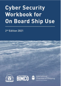 |
WITH 644 – Cyber Security Workbook for On Board Ship Use – 2nd Ed 2021 – Oct 2020
This workbook is a practical, straightforward and easy to understand guide to support the Master and the ship’s crew with cyber security risk management. Now in its second edition, the workbook provides detailed guidance on all aspects of cyber security protection, defence and response (including brand new sections on remote access, intrusion detection systems and engine department considerations). It is an essential tool in helping to ensure that cyber risks are appropriately addressed in onboard safety management systems (as required by IMO Resolution MSC.428(98)). It will also benefit shipowners, ship managers, ports and their IT departments. |
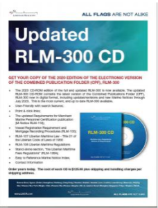 |
LBR 501 – Liberian Combined Publication Folder RLM 300/ RLM 300 CD – Aug 2020
The 2020 edition of the full and updated RLM 300 contains the latest version of the Combined Publications Folder (CPF) RLM 300 now in digital format, including updates/ revisions and new Marine Notices through Jul 2020. CPL/RLM 300 or CPL RLM 300 CD is required to be carried onboard each vessel in accordance with Liberian Maritime Regulation 1.13(3). The eRLM 300 CD meets the requirement for maintain the Laws and Regulations aboard Liberian flagged vessels. |
| To pre-order New Editions, contact our Customer Service Team at customerservices@voyagerww.com |
| OUTFIT MANAGEMENT TABLE |
| Forthcoming New Admiralty Charts/New Edition Charts to be Published in Week 41 |
| Chart
Title |
Chart Title | NE/NC | Date |
| IN472 | International Chart Series, Bay of Bengal and Andaman Sea, India – Andaman and Nicobar Islands, Nicobar Islands | NE | 08.10.2020 |
| IN473 | International Chart Series, Bay of Bengal and Andaman Sea, India – Andaman Islands, Andaman Islands | NE | 08.10.2020 |
| 235 | Davis Strait and South East part of Baffin Bay | NE | 08.10.2020 |
| 1603 | China – Chang Jiang, Inner Approaches to Shanghai | NE | 08.10.2020 |
| 1604 | China – Chang Jiang, Baoshan to Changshu Port | NE | 08.10.2020 |
| 1606 | England – East Coast, Thames Estuary, Fisherman’s Gat to Princes Channel | NE | 08.10.2020 |
| 1607 | International Chart Series, England – East Coast, Thames Estuary, Southern Part | NE | 08.10.2020 |
| 1609 | England – East Coast, Thames Estuary, Knock John Channel to Sea Reach | NE | 08.10.2020 |
| 2044 | International Chart Series, England – South Coast, Shoreham Harbour and Approaches | NE | 08.10.2020 |
| 3658 | Taiwan – North Coast, Chiu-Kang P’o-Ti to Kuei-Shan Tao | NE | 08.10.2020 |
| 4033 | Port of Singapore, Tuas Bay, West Jurong Channel and Pesek Basin | NE | 08.10.2020 |
| 4100 | International Chart Series, Norwegian Sea, Norway to Jan Mayen | NE | 08.10.2020 |
| 4113 | International Chart Series, Greenland and Norwegian Sea | NE | 08.10.2020 |
| 4114 | North Atlantic Ocean, Arquipélago dos Açores to Flemish Cap | NE | 08.10.2020 |
| 4203 | International Chart Series, South Atlantic Ocean, Ascension Island and Luanda to Walvis Bay | NE | 08.10.2020 |
| 4209 | International Chart Series, Atlantic Ocean, Freetown to Luanda | NE | 08.10.2020 |
| 4301 | International Chart Series, Mediterranean Sea, Western Part | NE | 08.10.2020 |
| Admiralty Charts to be Withdrawn in Week 41 |
| Chart Number | Chart Title | Replacement Chart Number |
| 235 | Davis Strait and South East Part of Baffin Bay | 235 |
| 825 | Bay of Bengal, Andaman Islands | IN473 |
| 840 | Bay of Bengal, Andaman and Nicobar Islands, Little Andaman to Great Nicobar | IN472 |
| 1603 | China – Chang Jiang, Inner Approaches to Shanghai | 1603 |
| 1604 | China – Chang Jiang, Baoshan to Changshu Port | 1604 |
| 1606 | England – East Coast, Thames Estuary Fisherman’s Gat to Princes Channel | 1606 |
| 1607 | International Chart Series, England – East Coast, Thames Estuary Southern Part | 1607 |
| 1609 | England – East Coast, Thames Estuary Knock John Channel to Sea Reach | 1609 |
| 2044 | International Chart Series, England – South Coast, Shoreham Harbour and Approaches | 2044 |
| 3658 | Taiwan – North Coast, Chiu-Kang P’o-Ti to Kuei-Shan Tao | 3658 |
| 4033 | Port of Singapore, Tuas Bay, West Jurong Channel and Pesek Basin | 4033 |
| 4100 | International Chart Series, Norwegian Sea, Norway to Jan Mayen | 4100 |
| 4113 | International Chart Series, Greenland and Norwegian Seas | 4113 |
| 4114 | North Atlantic Ocean, Arquipélago dos Açores to Flemish Cap | 4114 |
| 4203 | International Chart Series, South Atlantic Ocean, Ascension Island and Luanda to Walvis Bay | 4203 |
| 4209 | International Chart Series, Atlantic Ocean, Freetown to Luanda | 4209 |
| 4301 | International Chart Series, Mediterranean Sea, Western Part | 4301 |
| AUS208 | Australia – East Coast, New South Wales, Newcastle | Withdrawn |
| 8013 | Port Approach Guide, Rio de Janeiro | Withdrawn |
| 8014 | Port Approach Guide, Porto de Santos | Withdrawn |
| 8033 | Port Approach Guide, Paranaguá and Antonina | Withdrawn |
| 8036 | Port Approach Guide, Porto de Vitória and Porto de Tubarão | Withdrawn |
| 8048 | Port Approach Guide, Salvador and Associated Terminals | Withdrawn |
| 8049 | Port Approach Guide, Rio Grande, Porto Allegre and Terminal Santa Clara | Withdrawn |
| 8129 | Port Approach Guide, Porto de Itaqui and Terminal da Alumar | Withdrawn |
| 8223 | Port Approach Guide, São Francisco do Sul | Withdrawn |
| 8261 | Port Approach Guide, Açu | Withdrawn |
| New Edition Admiralty Publications to be published in week 41 |
| NP No. | Title | Date | Remarks |
| NP42C
e-NP42C |
ADMIRALTY Sailing Directions Japan Pilot Volume 4 Sixth
edition 2020.
ISBN 978-0-70-774-5794 |
08/10/2020 | Updated to Week 28/20
(09/07/20) First updates in NM week 41/20. This edition supersedes NP42C (Fifth Edition 2015) which is cancelled. |
| NP78 | ADMIRALTY List of Lights and Fog Signals Volume E First
Edition 2020 West Mediterranean.
ISBN: 978-0-70-772-4171 |
08/10/2020 | Updated to Week 36/20
(19/08/2020). First Updates in NM Week 41/20. Volume E 2019/20 is cancelled. |
| NP206-21 | ADMIRALTY Tide Tables, Volume 6, North Pacific Ocean
(Including Tidal Stream Tables) 2021 Edition
ISBN Number: 978-0-70-772-2344 |
08/10/2020 | New Edition for 2021 |
| NP286(4) | ADMIRALTY List of Radio Signals. Pilot Services, Vessel Traffic Services and Port Operations. Indian sub-continent, South East Asia
and Australasia. First Edition 2020.
ISBN Number: 978-0-70 774-4988 |
08/10/2020 | Updated to Week 34/20
(20/08/20). First updates in week 41/20. The 2019/20 Edition of NP286(4) is cancelled. |
 |
How can we help?
Our help team is on call 24/ hours a day 7 days a week including holidays. To speak with our Customer Service team, simply email us at customerservices@voyagerww.com, or contact your preferred Voyager Worldwide office here. |
